In an era where climate change poses an unprecedented threat to our planet, the need for accurate monitoring and reduction of greenhouse gas (GHG) emissions has never been more critical. As industries worldwide grapple with the challenge of balancing economic growth with environmental responsibility, a groundbreaking solution emerges at the intersection of artificial intelligence (AI) and satellite technology.
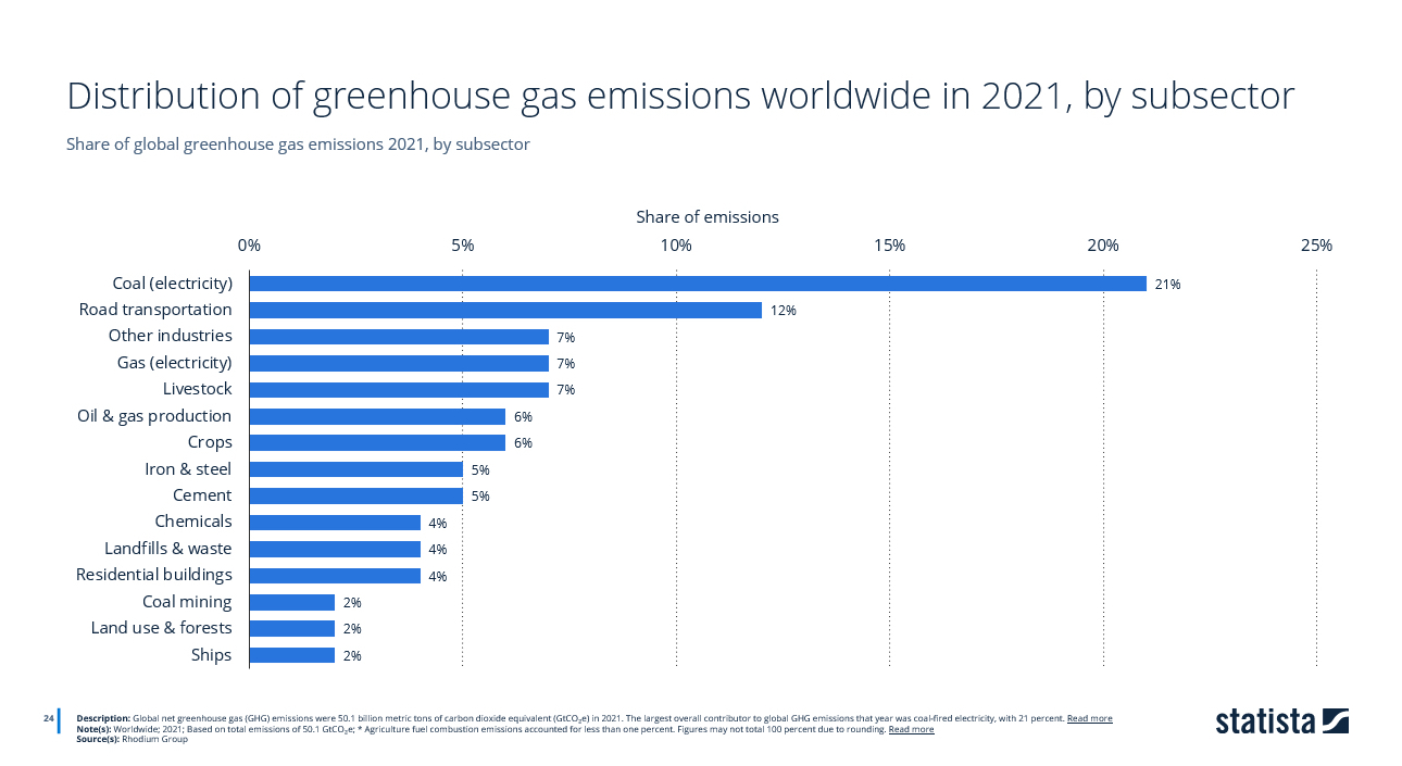
Data: Share of global greenhouse gas emissions 2021, by subsector
Source:Statista
Recent data from 2021 paints a stark picture: industrial and energy-related activities dominate global emissions, with coal-fired electricity generation leading at 21%, followed by road transportation at 12%. Other significant contributors include gas-powered electricity, livestock, and various industrial processes.
This distribution highlights the complex nature of our emissions challenge and the need for comprehensive monitoring solutions. However, a revolutionary approach is emerging at the intersection of artificial intelligence (AI) and satellite technology. By leveraging AI and satellite data, we now have the potential to track emissions from major contributors with unprecedented accuracy and scale, potentially reshaping our approach to climate action and industrial sustainability.
The Current Landscape:
Before delving into the transformative potential of AI and satellite data, it’s crucial to understand the current state of emissions monitoring. Traditionally, factories have relied on a combination of on-site sensors, manual inspections, and self-reporting to track their GHG emissions. While these methods have served their purpose to some extent, they are fraught with limitations:
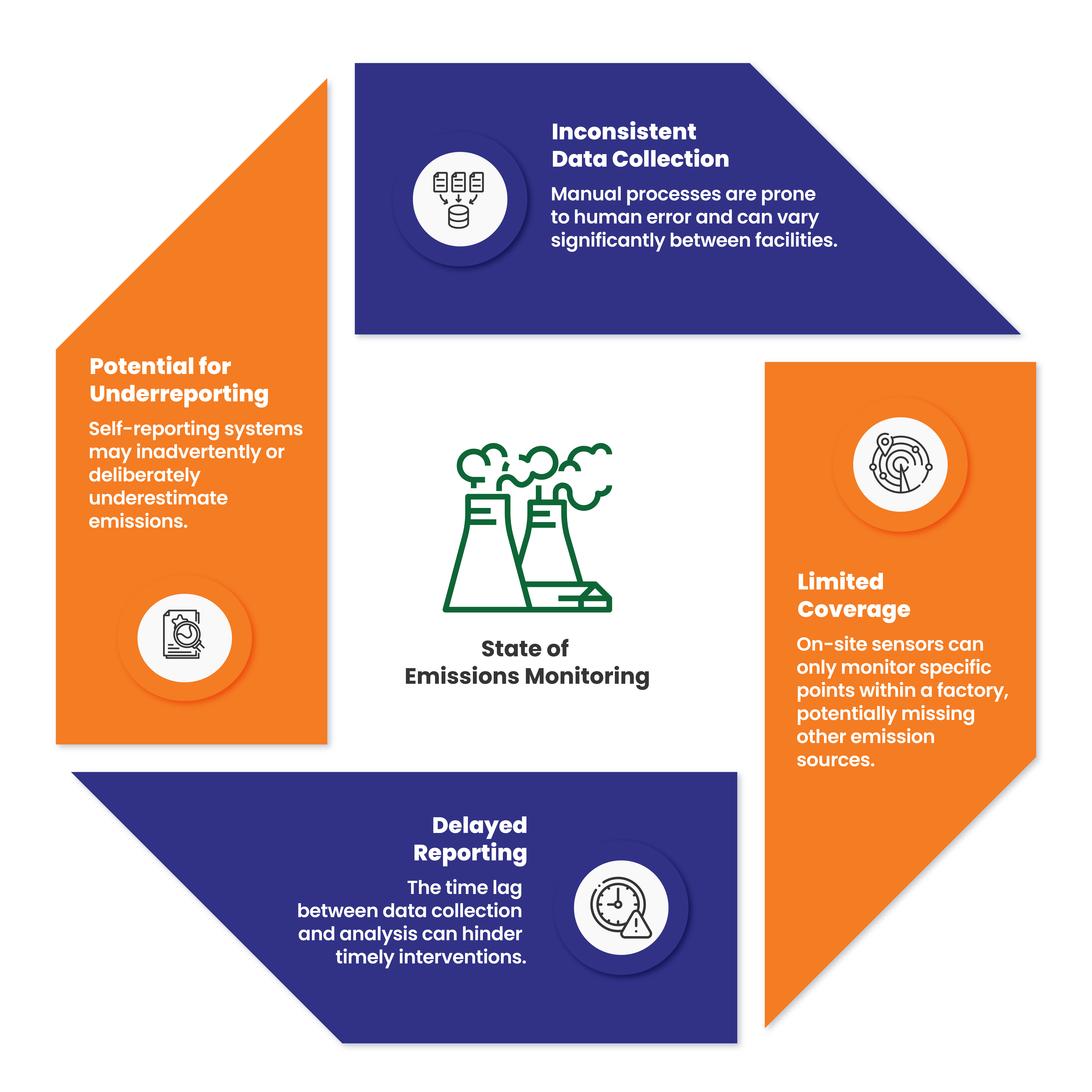
These challenges have long hindered efforts to accurately quantify and address industrial GHG emissions on a global scale. However, the integration of AI and satellite technology is poised to overcome these obstacles, ushering in a new era of precision and transparency in emissions monitoring.
The AI and Satellite Data Revolution:
The convergence of AI and satellite technology represents a quantum leap in our ability to monitor and analyze factory emissions. Advanced satellites equipped with multispectral sensors capture detailed images of industrial facilities and their surrounding areas. These images are analyzed to detect the unique spectral signatures of various greenhouse gases, including carbon dioxide, methane, and nitrous oxide.
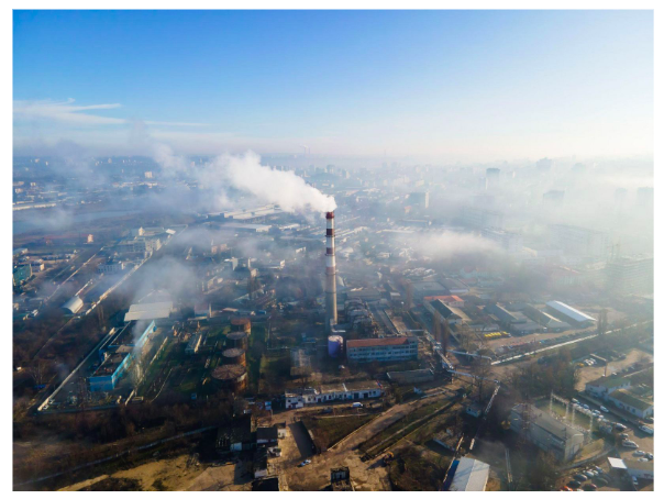
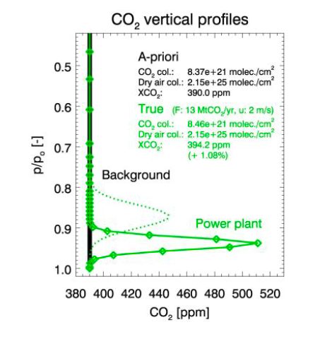
CO2 gas profile from power plant (Source: H. Bovensmann et al.: Monitoring CO2 emissions from space)
Satellite Monitoring of CO2 Emissions
CO2 is the most prevalent greenhouse gas emitted by human activities, primarily from burning fossil fuels. Monitoring CO2 emissions from factories involves several steps:
- Data Collection: Satellites equipped with spectrometers measure the concentration of CO2 in the atmosphere by analyzing the absorption of sunlight reflected from the Earth’s surface. Instruments like SCIAMACHY on ENVISAT and TANSO on GOSAT have been instrumental in collecting CO2 data.
- Spatial Resolution: High spatial resolution is crucial for identifying specific emission sources. A spatial resolution of 2×2 km², as mentioned in the study, can detect strong localized CO2 point sources, such as power plants.
- Frequency of Observations: Frequent observations are necessary to monitor emissions accurately. For instance, satellites in sun-synchronous orbit can provide data on each power plant every six days or more frequently, depending on the cloud cover and other atmospheric conditions.
- Accuracy and Precision: Achieving a precision of 0.5% (2 ppm) or better in measuring the CO2 column distribution is necessary to quantify emissions accurately. This level of precision ensures that even small emission changes can be detected.
Satellite Monitoring of CH4 Emissions
Methane is a potent greenhouse gas with a significant impact on global warming. Monitoring CH4 emissions from factories and other industrial activities involves:
- Dedicated Instruments: Satellites like CarbonSat, designed to measure both CO2 and CH4, use spectroscopic measurements of reflected solar radiation to detect methane concentrations.
- High Sensitivity to Near-Surface Changes: Methane emissions are often localized and require high sensitivity near the Earth’s surface to detect variations accurately.
- Handling Systematic Errors: Factors like wind speed and aerosol concentrations can affect the accuracy of CH4 measurements. By accounting for these variables, satellite data can provide more reliable emission estimates.
- Combining Data Sources: Using both passive and active satellite systems, as well as combining solar and thermal infrared observations, can enhance the detection and quantification of CH4 emissions.
Source: Bovensmann, H.,and et al: A remote sensing technique for global monitoring of power plant CO2 emissions from space and related applications, Atmos. Meas.
This integrated approach offers several game-changing advantages over traditional monitoring methods:
- Comprehensive coverage: Satellites can monitor entire industrial complexes and their vicinity, providing a holistic view of emissions that may be missed by point-source measurements.
- Objectivity and consistency: By relying on standardized satellite data and AI analysis, this method eliminates the variability and potential bias inherent in manual reporting.
- Global scalability: The same technology can be applied to monitor factories worldwide, creating a standardized system for international emissions tracking and comparison.
- Cost-effectiveness: Once the initial infrastructure is in place, satellite-based monitoring can be more economical than maintaining extensive networks of ground-based sensors.
Overcoming Challenges and Limitations:
While the potential of AI and satellite-based emissions monitoring is immense, it’s important to acknowledge and address the challenges associated with this technology:
- Atmospheric interference: Cloud cover and atmospheric conditions can affect the quality of satellite imagery. However, advances in radar technology and increased satellite coverage are mitigating this issue.
- Data processing demands: The sheer volume of satellite data requires significant computational power. Cloud computing and edge processing solutions are being developed to handle these demands more efficiently.
- Calibration and validation: Ensuring the accuracy of AI interpretations requires ongoing calibration against ground-truth data. This necessitates collaboration between satellite operators, AI developers, and environmental scientists.
- Privacy concerns: Some industries may express reservations about the constant monitoring of their facilities. Clear regulations and data protection protocols will be essential to address these concerns.
- Initial investment: The development and deployment of satellite networks and AI systems require substantial upfront investment. However, the long-term benefits in terms of environmental protection and regulatory compliance far outweigh these costs.
Implications for Industry and Regulation:
The adoption of AI and satellite-based emissions monitoring has far-reaching implications for both industry and environmental regulation:
- Enhanced compliance: Regulators will have access to more accurate and timely emissions data, enabling stricter enforcement of environmental standards.
- Leveling the playing field: A standardized, global monitoring system will ensure that all industries are held to the same standards, preventing companies from gaining unfair advantages through underreporting.
- Incentivizing innovation: With increased transparency, companies will be motivated to invest in cleaner technologies and more efficient processes to reduce their emissions footprint.
- Carbon trading and taxation: More precise emissions data will facilitate the development of fairer and more effective carbon pricing mechanisms.
- Public accountability: Easy access to emissions data will empower consumers and investors to make more informed choices, driving market pressure for sustainable practices.
The Road Ahead: Future Developments and Opportunities
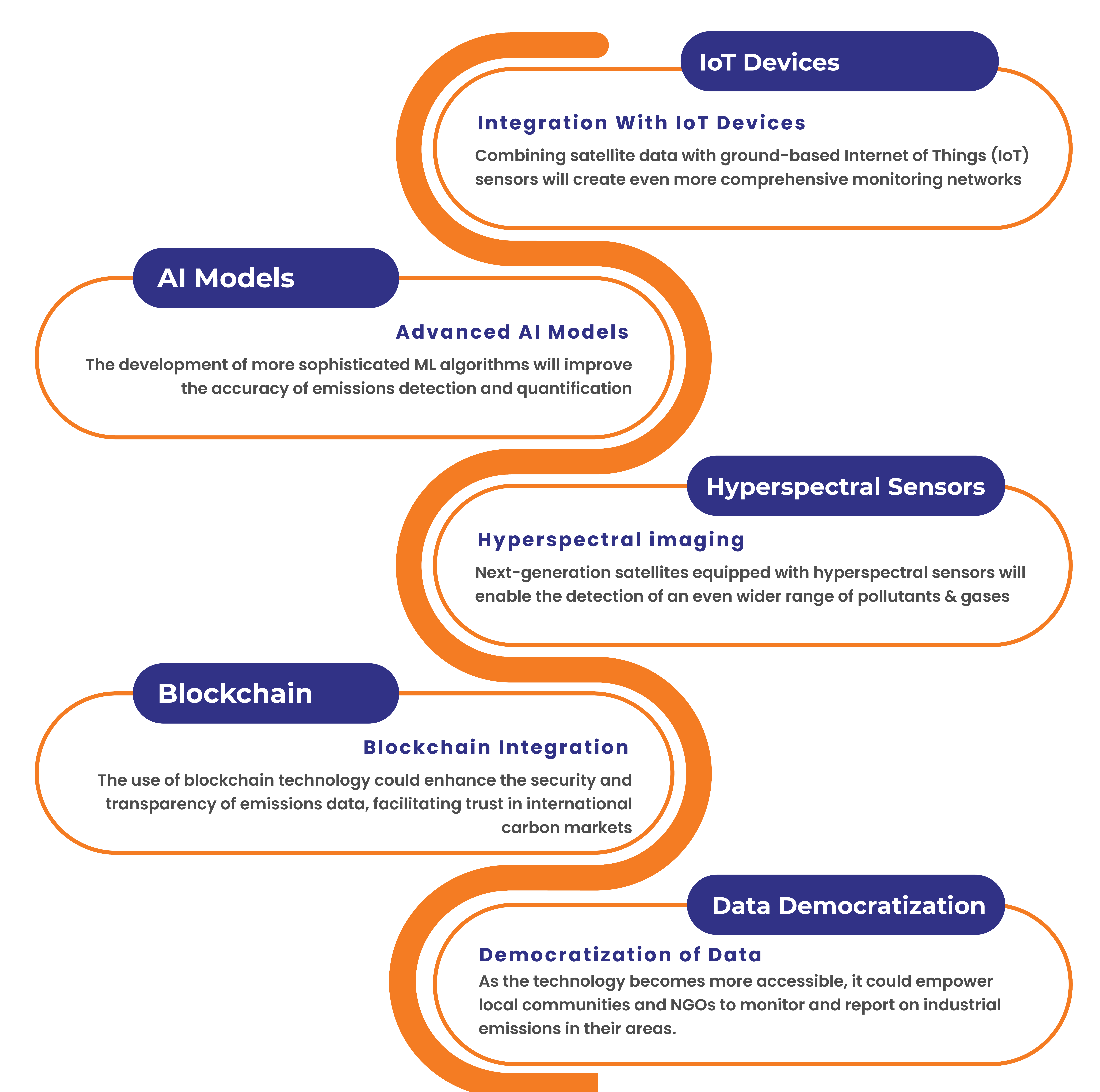
As AI and satellite technology continue to evolve, we can anticipate several exciting developments in emissions monitoring:
Conclusion: A New Era of Environmental Stewardship
The integration of AI and satellite technology for monitoring factory greenhouse gas emissions marks a pivotal moment in our fight against climate change. This innovative approach not only promises more accurate and comprehensive emissions data but also has the potential to transform how industries, regulators, and the public engage with environmental issues.
As we stand on the brink of this technological revolution, it’s clear that the benefits extend far beyond mere compliance. This new paradigm of emissions monitoring will drive innovation, foster accountability, and ultimately accelerate our transition to a more sustainable industrial future.
The challenge now lies in rapid adoption and implementation of these technologies on a global scale. It will require collaboration between governments, industry leaders, technology providers, and environmental organizations. But with the stakes so high and the potential so great, embracing this AI-powered, satellite-enabled future is not just an option – it’s an imperative.
In harnessing the power of AI and satellite data to monitor factory emissions, we’re not just observing our impact on the planet; we’re taking a giant leap towards actively shaping a cleaner, more sustainable world for generations to come.


